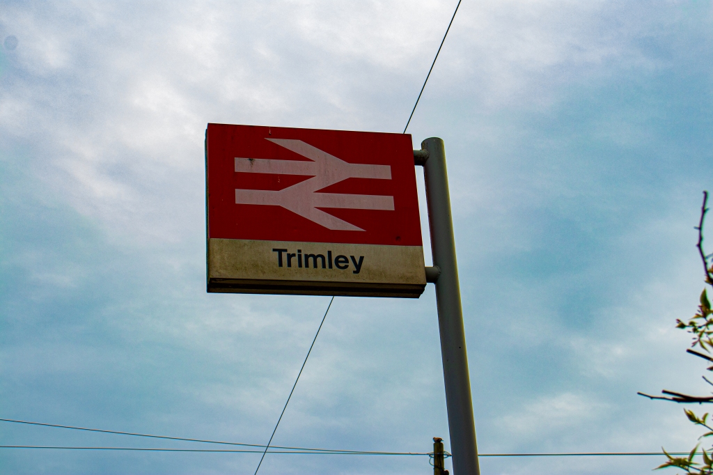
Trimley was opened in 1891 by the Great Eastern Railway. Its primary purpose was to fill the gap between the station at Orwell and Felixstowe beach, both of which were substantially far away from the village.
A few freight lines were here, but were withdrawn in 1964, and in 1967 the station building was closed. This meant that together with the rest of the branch line, the station became a “pay train” station, with the guards collecting fares. This left only the signalmen at the station, whose purpose was to operate the level crossing and signalling away from the station.
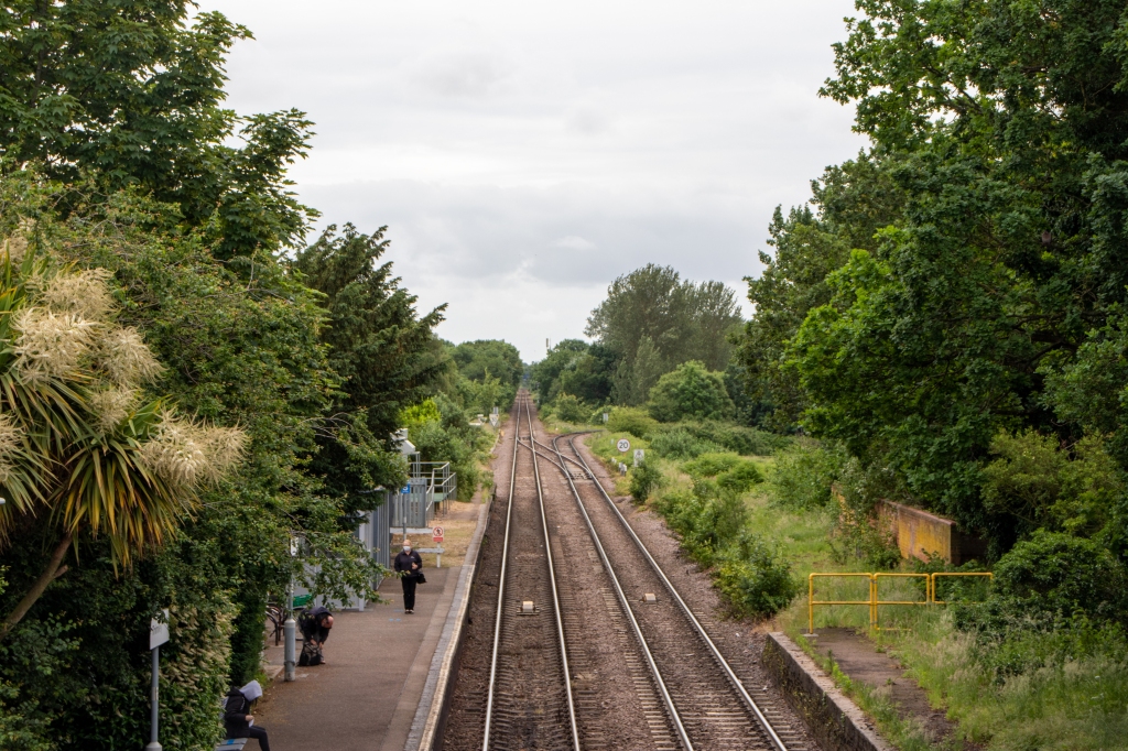
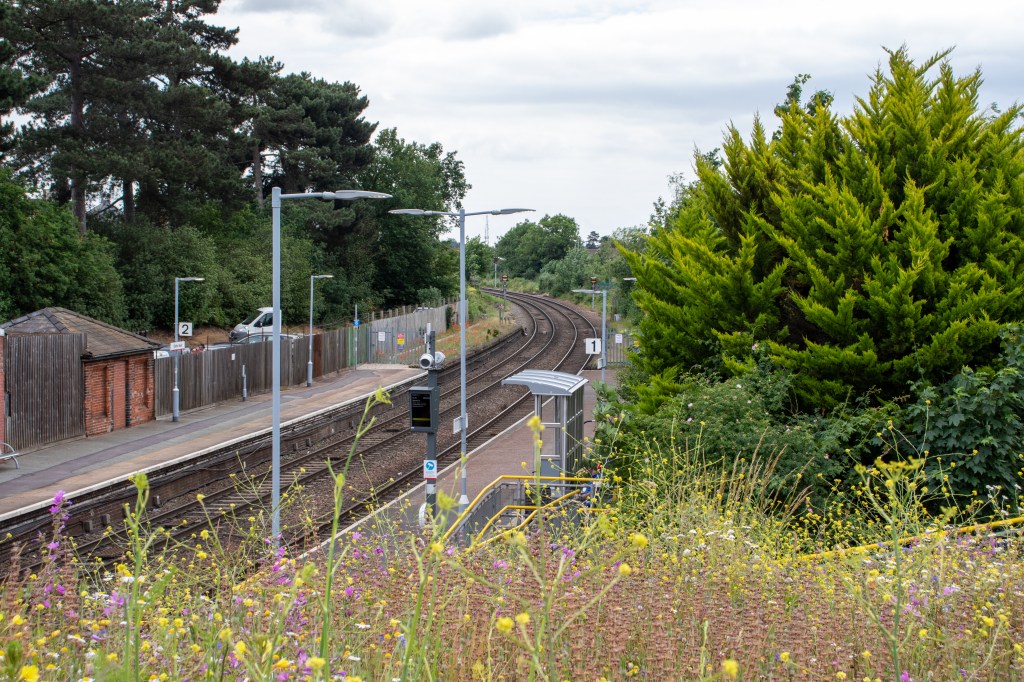
A direct line to the docks at Felixstowe was opened in 1970, and 17 years later in 1987, the spur down to the north freightliner terminal was opened to the south of the station.
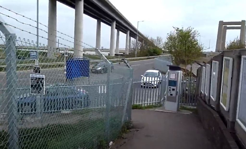
The spur to the North terminal is clear to see on the right
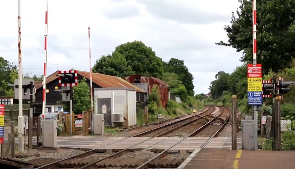
The removal of the signal box in 1997 meant the installation of the automatic barriers, and control of these and the points was now undertaken by the Colchester panel signal box.
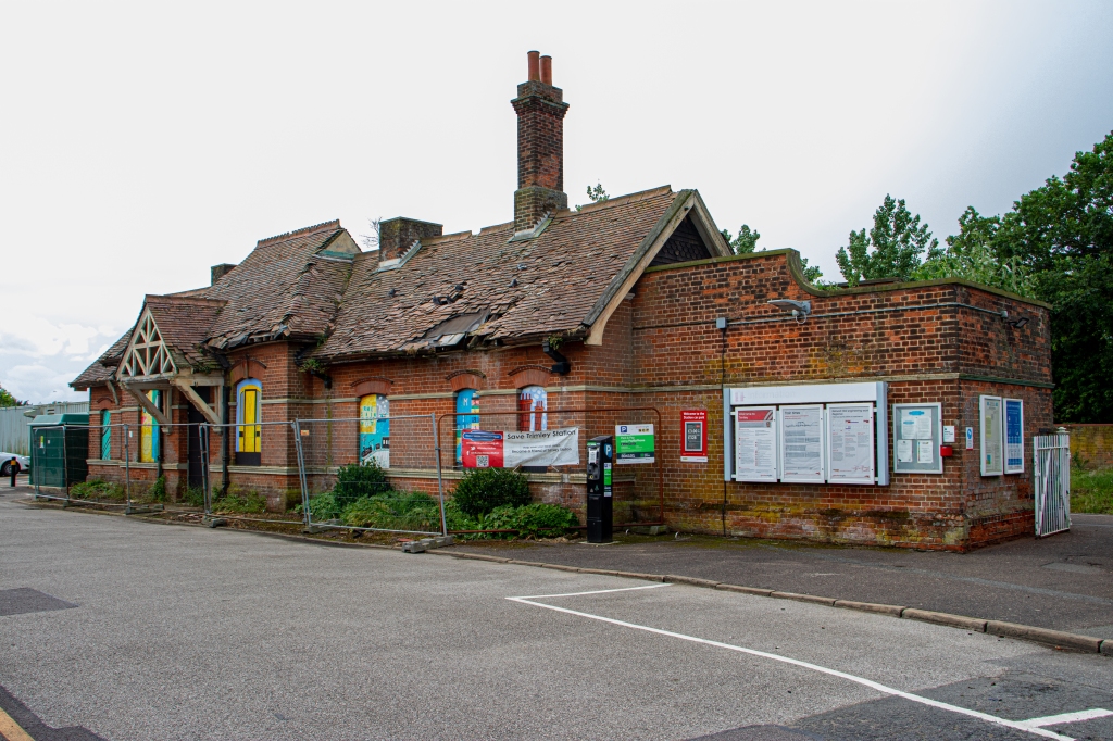
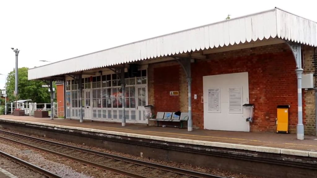
The station building was a version of a new Essex style, one of only two to be built outside Essex. Its interior would have included a first class waiting room, porters lodge, booking office and combined booking hall and waiting room. A ladies room with toilet completed the facilities.
There was also a small building on the other platform, but this was demolished a long time ago.
Although at time of filming it is in a very bad state, it is still standing, and is now under control of the Trimly station community trust. They gained control of a long term lease in 2011. Their ambition is similar to that of the station at Wickham Market, to transform the station into a café and meeting room whilst preserving the station fabric.
They have a long way to go, and recent months (2021/2022) have seen Greater Anglia seek improvements to the station which ‘may’ involve the demolition of the building, but nothing has been set in concrete. Hopefully in the coming months both fundraising and grants may become available, however multiple applications to the national lottery heritage trust have not borne fruit. I do hope this situation changes for the better, as it would be a shame to lose such a quaint and historically important station. If you wish to know more, I have provided a link in the video description below.
Facilities include a waiting shelter, help point, electronic ticketing machine and new style service information boards.
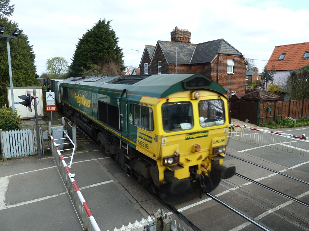
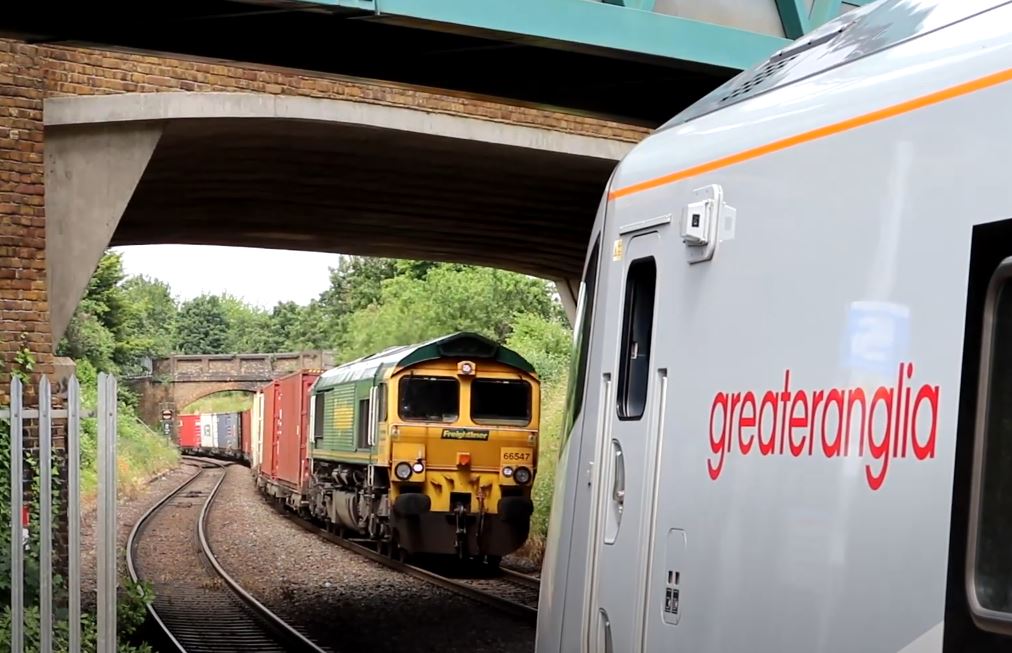
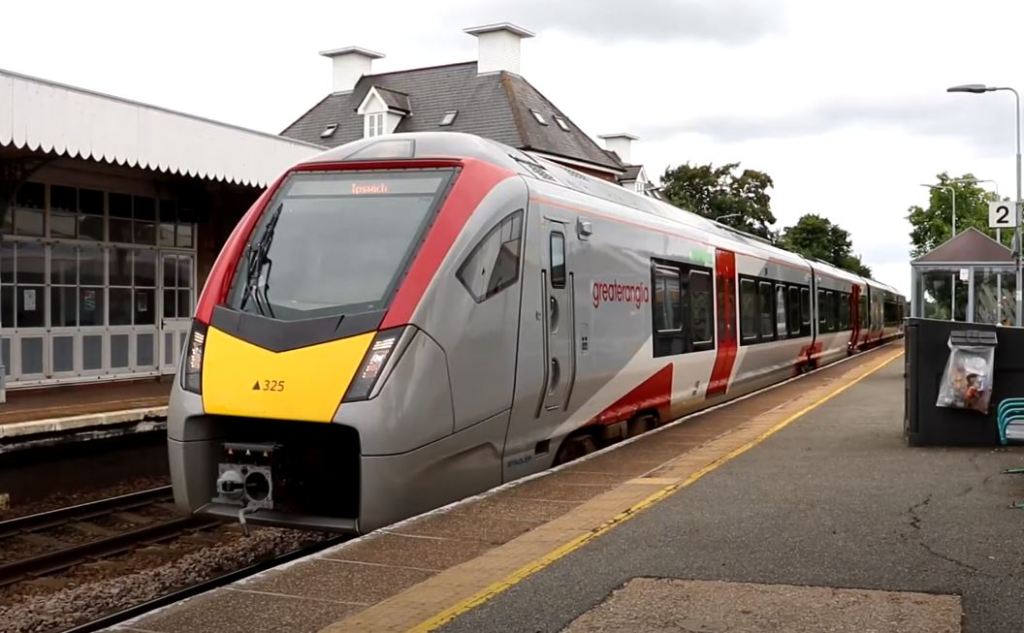
Passenger traffic at time of writing is provided by class 755 Bi-Mode units, and almost all freight is hauled by class 66 Locomotives.
A class 66 heads towards Felixstowe
The entry and exit figures for 2019 / 2020 were 31, 122. These figures are used as the figures for 2020 / 2021 are unreliable due to being very skewed by the pandemic.
Still a functioning station for the village, Trimley could be so much more. I hope that the building gets funding and finally gives the village a focal point it deserves.
For the enthusiasts, obviously the abundance of freight (albeit only intermodal) plus excellent sightlines, gives plenty of video and photo opportunities.
I recorded a video for this station in 2021, and you can view it below :
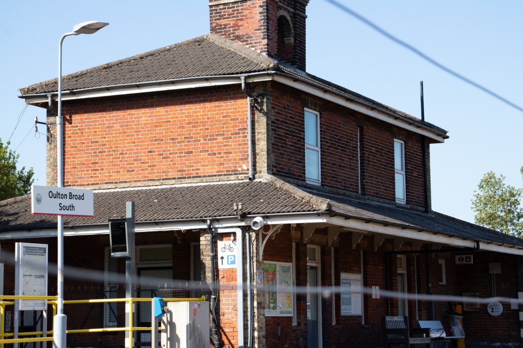
Opened in 1859 by the East Suffolk Railway, it was originally named Carlton Colville. The line like most in Suffolk was amalgamated with the Great Eastern Railway shortly after. The station wasn’t renamed to Oulton Broad South until 1927
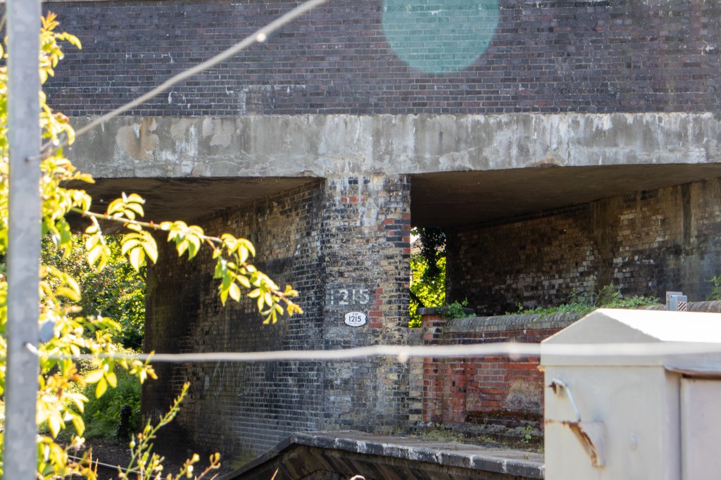
Just to the east of the station under the road bridge, the line split to the Kirkley branch, with services to sites on Lake Lothing.
These included sidings into Kirkley goods depot. Companies using these would include Boulton and Pauls canning products, and confectionery from Mortons and the co-op group. This line was fully closed in 1972, and no real trace of it remains.
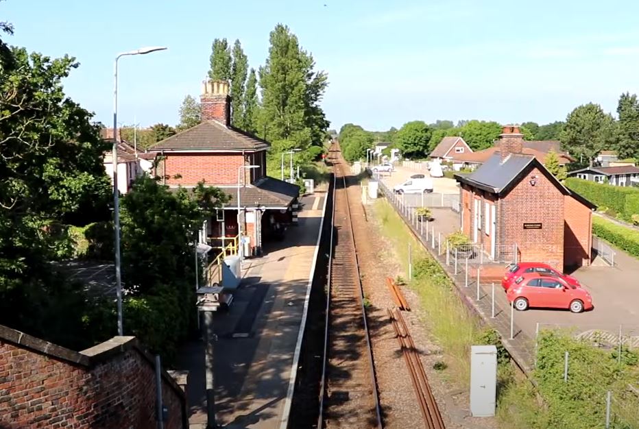
A station building remains on the working platform, the line here being single running at this point since the late 1980’s. However the other platform remains with a building which is used for small businesses. The small goods yard which was adjacent to that platform is now a car park, but its history contains the fact that pullman camping coaches were positioned here between 1952 and the late 1960’s
This view from the road bridge shows clearly that the line used to be double tracked at this point.
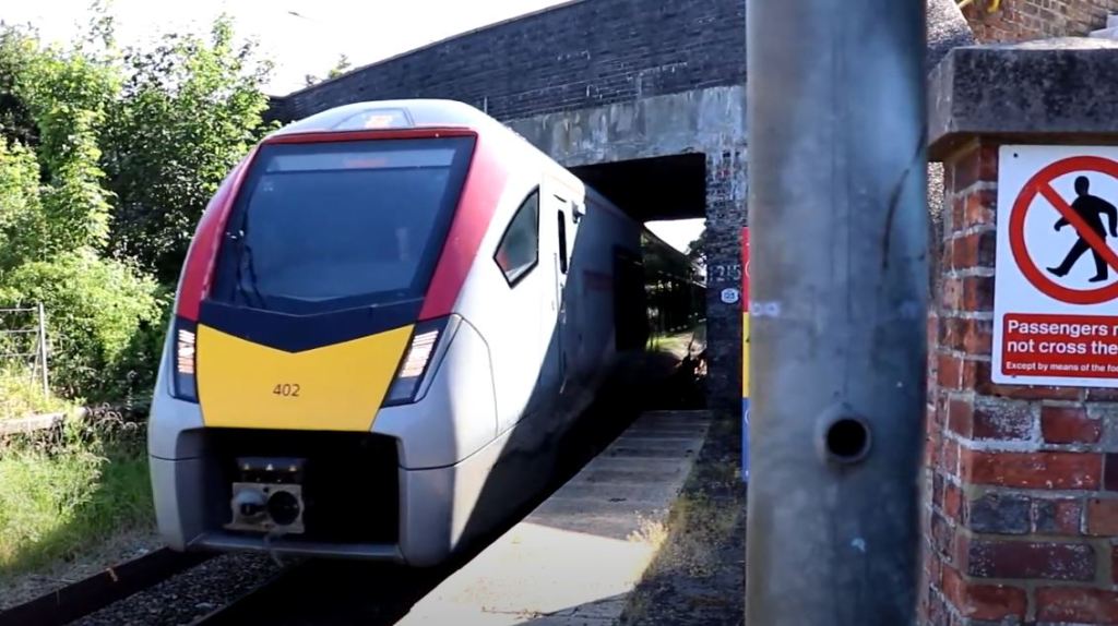
Passenger services at time of writing are provided by class 755 bi mode units.
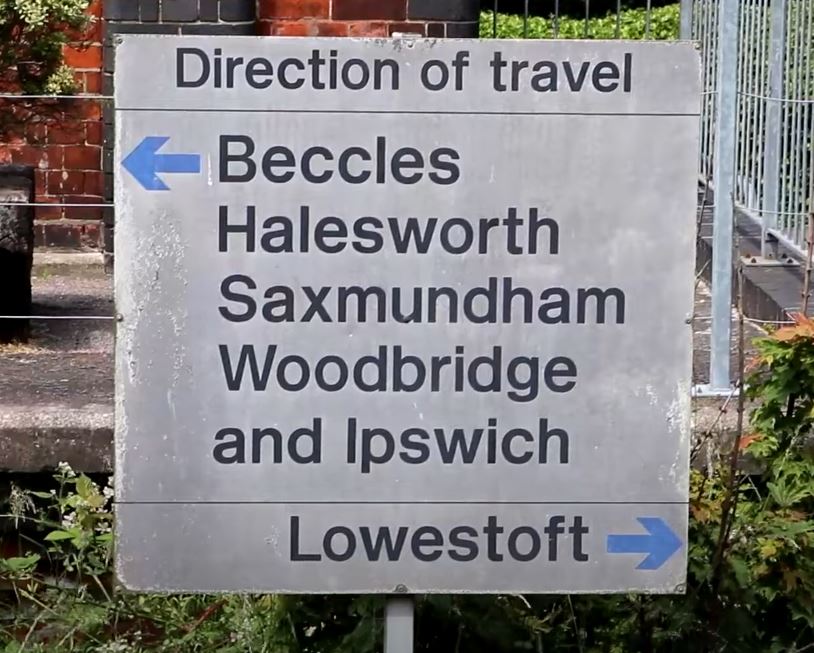
As far as facilities go, the station has an electronic ticketing machine, help points and posters not only for the regional rail network, but also information about the area. There is also this old style ‘direction of travel’ board, which is great to see.
The passenger entry and exit figures for 2019/2020 were 43, 518
Oulton broad south is a quiet station, but is still used fairly frequently. The fact that both platforms remain is great, and the station buildings, although not being used for their original purpose, are still in situ. For the enthusiast, although sight lines are good, the absence of freight means that traffic is very light indeed.
My 2021 Vlog from the station can be viewed below.
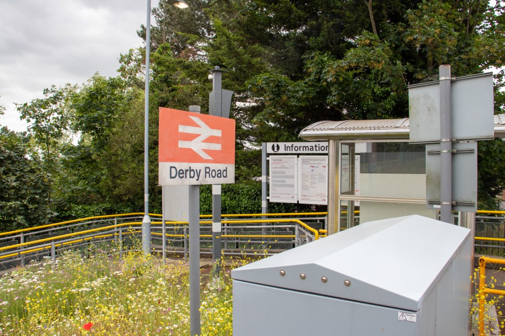
Derby Road was opened in 1877 by the Felixstowe railway, and was amalgamated into the Great Eastern Railway in 1879. It only had one platform originally, but due to popularity gained a second one in 1891
This popularity was due to the Ipswich tramway terminating at this point. Passengers going to Felixstowe for the day would get the tram from Ipswich and get the train from Derby Road. In fact, during the summer many trains would terminate at Derby Road from Felixstowe, instead of going though to Ipswich
The trams continued until 1926 when they were replaced by trolleybuses, but these too were fully phased out by 1962. Some of these can still be seen at the Ipswich transport museum, a link to which is at the end of this blog.
Getting back to the station, it also had two sidings, which were increased during the early 20th century, but like most in the country were phased out by the late 1960’s
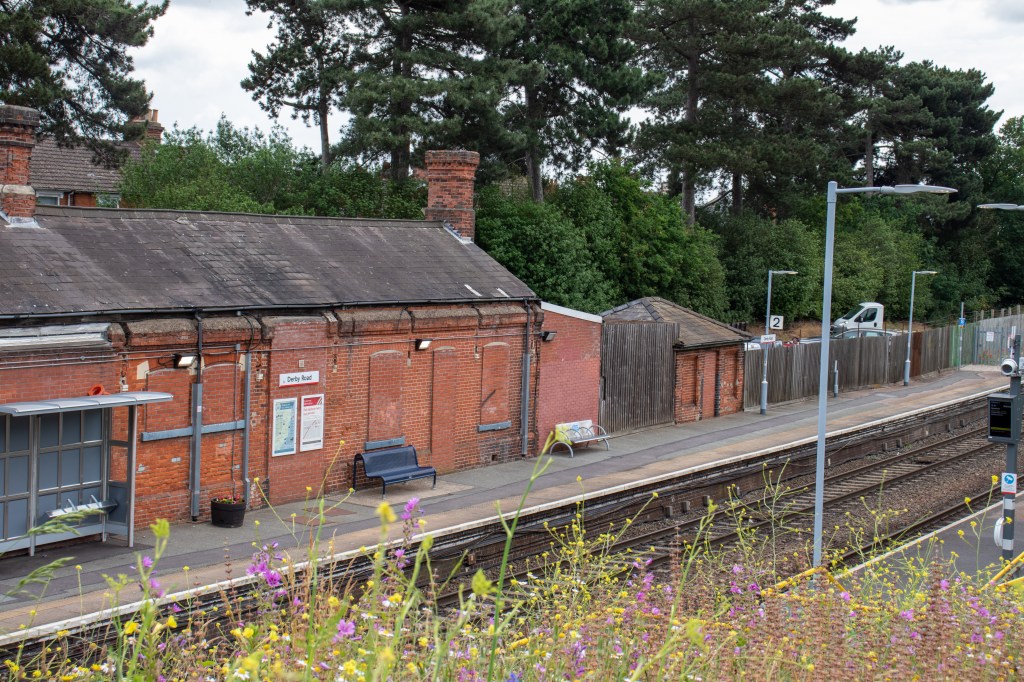
The station building still stands, although not used today. Originally it had a fine canopy and a similar structure was to be seen on the other platform. This other building no longer survives, as well as the canopy on the main building. The other notable absentee is the signal box which was on the Felixstowe side of the station.
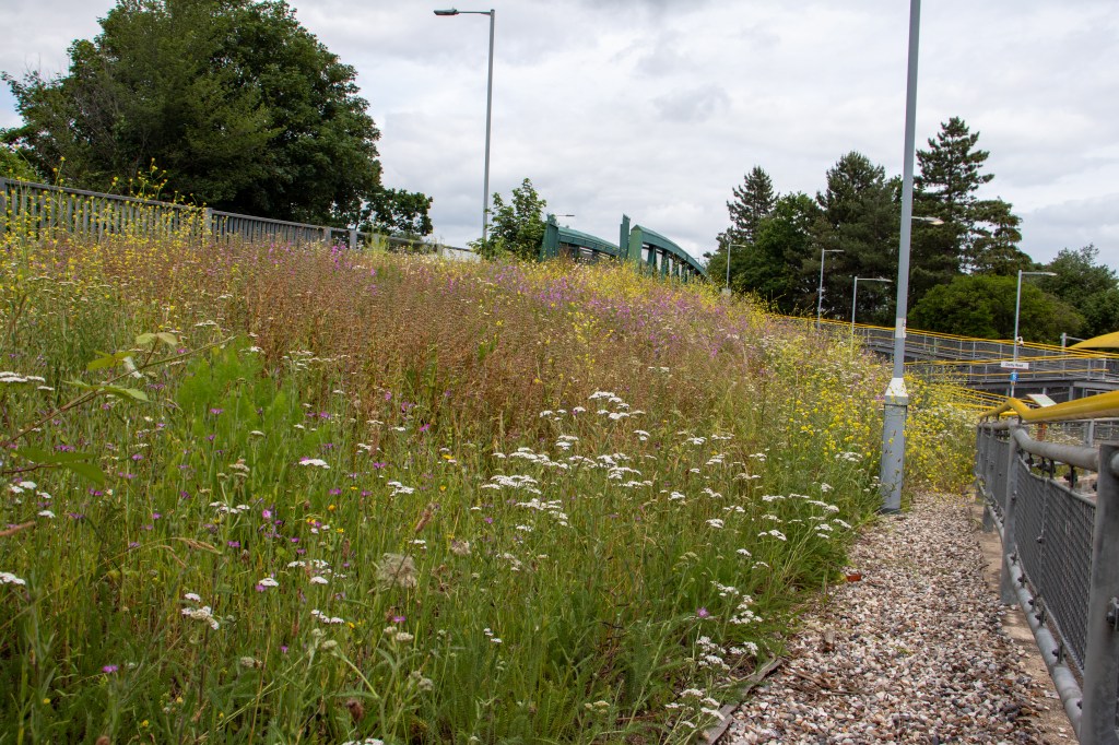
However, this does not mean the station has been left unkept. In fact in late 2020, work was started to create a wildflower garden on the entrance to platform one. Supported by the East Suffolk Community Rail Partnership, Greater Anglia Railway, Ipswich Friends of the Earth and Ipswich Council, it really adds colour to the station and makes it feel very well looked after.
An additional poppy patch is situated on the Felixstowe end of platform two.
Many of the freight headed towards Felixstowe will stop here, as the line after the station becomes single line running for a few miles. These are at time of writing mostly hauled by class 66 locomotives, and passenger traffic is provided by class 755 Bi-Mode units.
The entry and exit figures for 2019 / 2020 were 46, 808.
In conclusion, Derby road was once an important interchange for the passengers from Ipswich to the coastal town of Felixstowe. However after the 1960’s, most passenger traffic would be confined to the local area. The expansion of Felixstowe port has brought many more freight trains through the station, these quite often stop in the loop. Great views can be had of both freight and passenger traffic, especially through the curves towards Ipswich. The station benefits from the new wildflower garden, and generally speaking is a good place for the intermodal freight enthusiast.
A large village between Stowmarket and Bury St Edmonds, Elmswell is certainly deserving of a station with a rich history of manufacture.
The line was opened by the Ipswich and Bury railway company in 1846, serving the towns of Bury St Edmonds and Ipswich. A lavish station building on the Ipswich side was built and opened at the same time.
The station passed onto the newly formed Great Eastern Railway in 1862, who added a waiting room and toilets on the Bury St Edmonds side of the station.
In the early 1900’s, a line ran from the sidings to the west of the station to the Woolpit Brick Company, which famously produced white bricks. It used three steam locomotives. Other companies which used siding space during the 1900’s were a bacon factory, Beer & Sons and St Edmundsbury Co-op. Due to lack of traffic, the yard closed in 1964.
Elmswell became an unstaffed halt in 1967, and ‘Pay-Train’ working was to be introduced on the line. Unfortunately the main station buildings on the north platform were demolished in 1974 and the signal box succumbed to the same fate in 1986.
However, the buildings on the other platform remain. These still retain the Great Eastern Railway marking on the canopy steel works, and look to have been freshly painted when I visited in 2021.
The actual building is being let out as business space, and I was pleased to see them being used.
Behind these buildings is a very small car park, perhaps for only 3 or 4 cars. The level crossing has for some time been fully automatic. The rest of the station has small waiting shelters, help points, regional and local maps. There is even an amazon pick up point on platform one. Flower boxes enhance this little station, and it is clean and tidy throughout.
Passenger traffic at time of writing is provided by class 755 Bi-Mode Units. There is quite a lot of freight based traffic to and from Felixstowe also, mainly hauled by class 66 Locomotives.
Entry and exit figures for 2019 / 2020 were 71, 050.
Elmswell is a functional station, and even if the main station building has gone, the other smaller building complete with its nods back to the past helps keep the history alive
Below is the vlog I shot for this series, there is a link at the end to the playlist for the whole series, I hope you enjoy watching it.
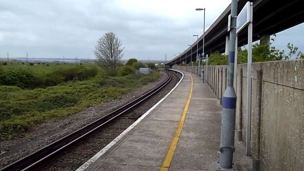
Swale really is remote, no real housing or commercial buildings are nearby, and it is amazing it is still used. However it does have an interesting and important part to play in the history of the line.
The station was opened in 1913 as Kings ferry bridge halt, and as such had no station building, just a couple of small huts for shelter. It traversed the River Medway over a bridge, but after a ship collided with the bridge in 1922, it was deemed unfit for railway traffic.
This meant that passengers were required to exit this station and walk over a temporary bridge to another station which had been provided to continue their journey. This change meant the renaming of the station to Kings ferry bridge south halt.
It was renamed again in 1929 to Swale Halt when the railway bridge reopened after repairs, and continued with this name until a new bridge was opened in 1960, when it became known just as Swale station. The station is very remote, the nearest village being Iwade, which is a 25 min walk away.
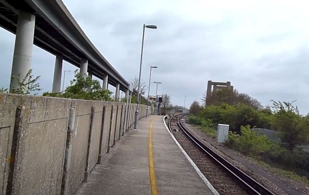
There is one dot matrix display, positioned at the top of the ramp which from the very small car park (which is in fact where the replacement bus service would pick up and set down. At the bottom of this ramp is an electronic ticketing machine. Turning back to walk up the ramp, on your left are various poster boards.
These include timetables, service information, a board for the Kent community rail partnership and of course an onward travel information board. Like others on this list, there are no other facilities here. Trains at time of writing are class 375 electric multiple units.
Passenger entry and exits for 2019 / 2020 were 8, 044. I am using these figures as the figures for 2020 / 2021 are skewed due to the pandemic, and so are unreliable.
The video for Swale, recorded before the Class 375’s took over the line can be seen below.
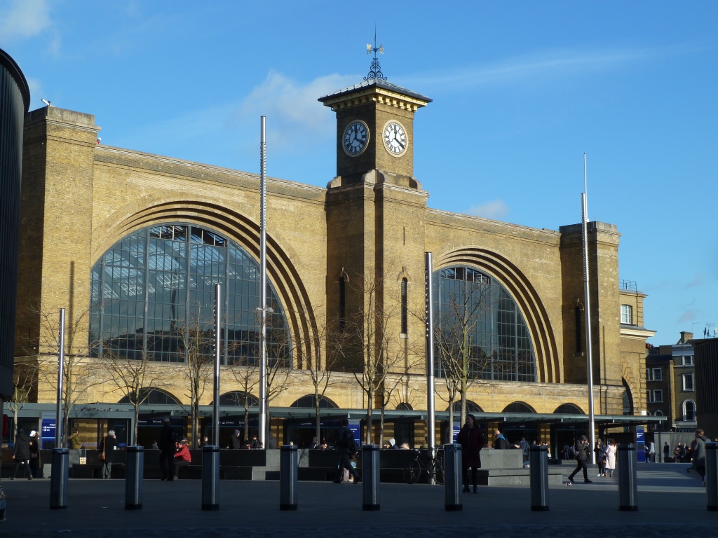
London Bridge is the oldest of the Termini in London, and one of the combined termini where terminating platforms are alongside through services. Often derided in the past as gloomy and difficult to navigate, a 21st Century makeover was completed in 2018. It is now a sleek modern building, its angled lines smoothed out with a curvy façade on one side. London’s tallest building, The Shard, towers above it, literally pinpointing the stations position.
A brief history
In 1831 a railway was proposed between Greenwich and Tooley Street. Because it would run through very congested streets, it was agreed that the best course of action was to build a viaduct. This would become a huge 878 arch bridge, made from 60 million bricks which were made in Sittingbourne, Kent. Initially the viaduct had a walkway which people could use for the sum of 1 pence, enabling elevated views of the city. However this was closed during the expansion of 1840.
Partly opened in 1836 as far as Spar Road, the full line to London Bridge was opened in December 1836. The station at this time was very basic, steps or ramps up to the platforms which were totally open to the elements having no sheltering roof or trainshed whatsoever.
Expansion came very quickly, with the London and Croydon Railway Company and The South Eastern Railway company taking routes North and South respectively between 1839 and 1842. The increased traffic gave the station a new building in 1844, the first of many rebuilds London Bridge would have.
The most significant of these was in 1850, where the station was divided in two, the South Eastern taking control of the North side, and the newly formed London, Brighton and South Coast railway company the South side. A huge wall was erected, with both sides having differing rules and regulations, causing services such as horse drawn taxis to pay differing charges as they traversed the station.
This remined in place until 1923, when all the southern rail companies were amalgamated into the Southern Railway Company. A footbridge was built to link the two stations in 1928.
The arches under the station were used in the Second World War as air raid shelters, although conditions were very grim. Inspections declared they were unfit for use and demanded improvements to make them both safer and hygienic. Unfortunately, before any real improvements were made, a bomb hit London Bridge in February 1941, killing 68 and injuring a further 175.
A Major rebuild of the infrastructure and station occurred in the 1970’s. This included new signalling and rerouting of the lines in and out of London Bridge. The building was given a modern design, but people would still complain that it was cramped and uninviting.
It wasn’t until the early 2000’s that another rebuild would take place. The most radical and expensive so far, this time they seem to have got it right , as I shall explain in the rest of the blog.
A quick view of the current station
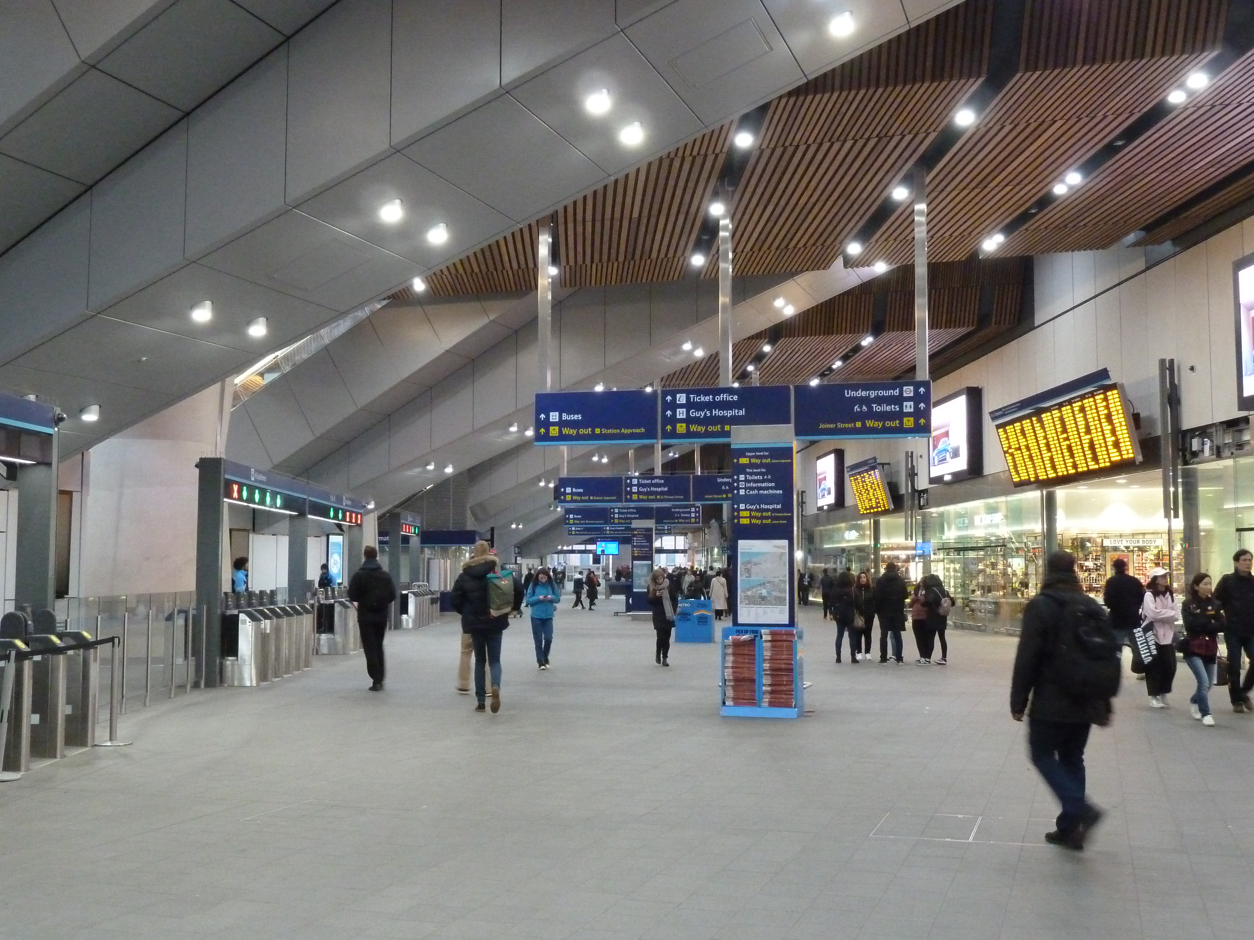
Although I label this as a quick view, the station is so vast that being quick here is not something i’d recommend if you wish to appreciate this new station.
Entering from the underground station, after going up the escalators you enter a passageway which is Joiner Street. Move into Joiner Street and you should soon see on your left the entrance to the Western Arches.
The Western Arches
Moving into here, the old pillars that are holding up the railway above you, go down this corridor in a pleasant symmetrical fashion. Shops are placed at the side, and the feel of this section is fantastic.
At the end of the passageway is another intersection, this time with Stanier street. Of note here is the plaques along the wall detailing the history of the station layout, well worth a look if you have the time.
Plaque in Stanier Street
Moving back to the end of the Western arches, and head of you is the main concourse – a sleeper in on one of the walls just as you are about to enter the concourse is dedicated to the opening in 2018.
Dedication plaque
Turning right here will take you down past more shops on your right, and the main ticket office on your left. Carry on down to the exit and you will see on your left a memorial to the railway workers who died in the first world war. This exit would take you into St Thomas’ street, next to St Thomas’ hospital, should you go through it.
First World War Memorial
Turning back into the main concourse, head all the way back to the Western Arches and carry on. You will see various gateline entrances to your right, as well as a big escalator and stairs in the middle which will take you up to the upper concourse and the bus station. Lets go up and take a quick look.
Up the escalator ahead of you is the glass frontage of what used to be known as the main entrance to the station. If you were to exit there, the Shard would be immediately to your right, with the bus station immediately in from of you. It is worth going out here just to marvel not only at the Shard, but the impressive all glass frontage to the station here (see the opening picture of this blog post).
Moving around the upper concourse the sense of natural light and space is very evident. Moving to the left you will find gatelines for Platforms 10-15. If you gain access to these platforms, try to take a moment to stand at the end of the terminating platforms, and you will be greeted by a very pleasant sight as the canopy structure over the platforms snakes away from you, yet another good photo opportunity.
A view down platforms 14 and 15
Lets go back downstairs to the main concourse, and turn right towards the exit for Tooley Street. Various gatelines will be on your right, as well as an information centre. Exiting into Tooly Street will give you a look at the new sweeping façade at this entrance. This mixes well with the original arches, which can be seen meandering away towards Greenwich. The view as you enter the station again is below.
View after entering via Tooley Street, note the huge escalators towering above you.
Moving into the station, we go through a gateline into the inner concourse. Impressive concrete pillars, looking like huge egg timers, are dotted around, with seating around their circumfrence. The space here is very welcoming due to the high ceiling. Various lifts are in the centre too, and ahead of you are the huge escalators which take you to platforms 1-15.
A view across the concourse post gateline, with the lift shafts, pillars and high roof.
Departure boards are placed around the lifts and on the side walls, really the wealth of information about arriving and departing train services is comprehensive.
I visited during rush hour, and yes it was busy, but the station layout as it is now didn’t seem to have any major congestion points. The station and surrounding structure is still being worked on, but all the major components are open, and it seems that at last London Bridge is able to cope with the passenger numbers it receives.
The video below shows London Bridge platforms at evening rush hour.
King’s Cross; for a lot of people the station symbolises two very different train services. One steeped in history – The Flying Scotsman – the other pure fantasy – The Hogwarts Express. Whilst one is real and the other fictitious, it is fair to say that if you mention Kings Cross to many of the public, they will utter either or both of them.
A brief history
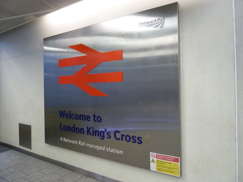
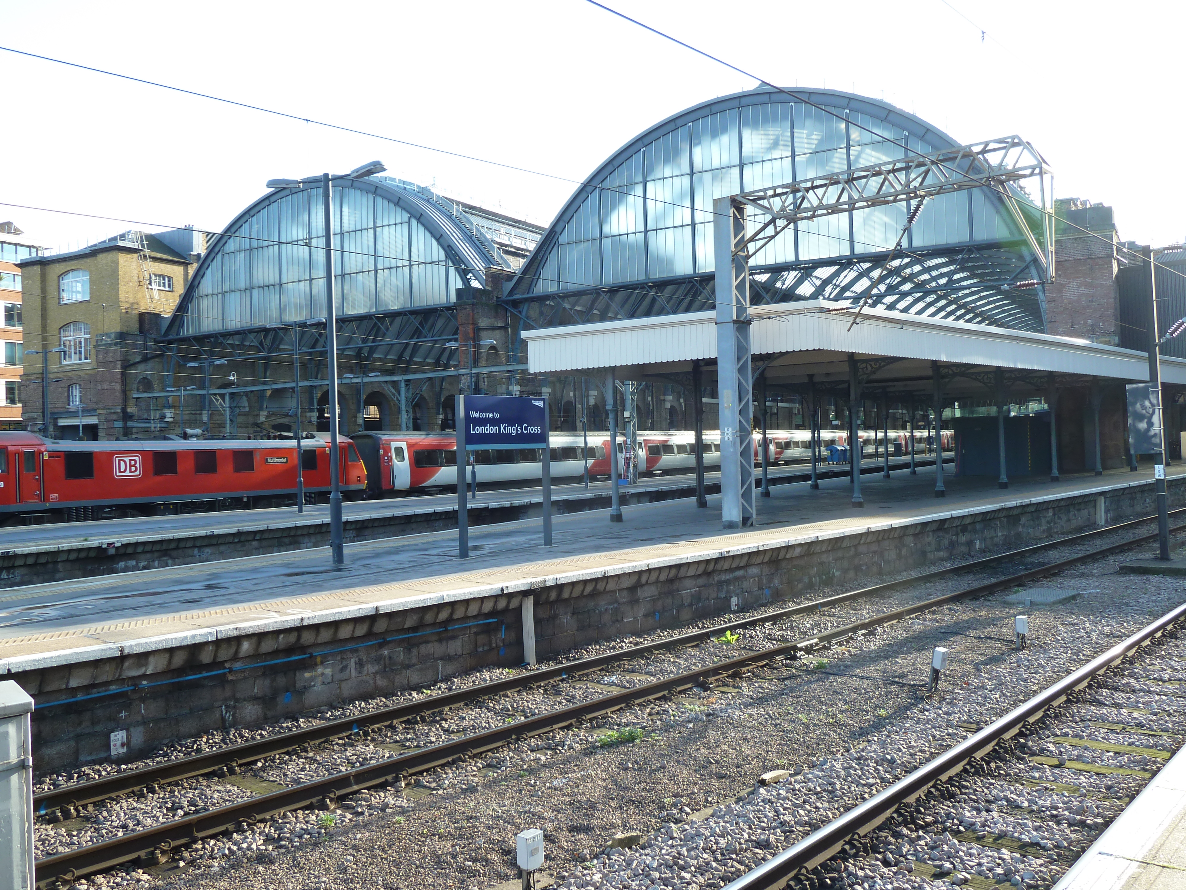
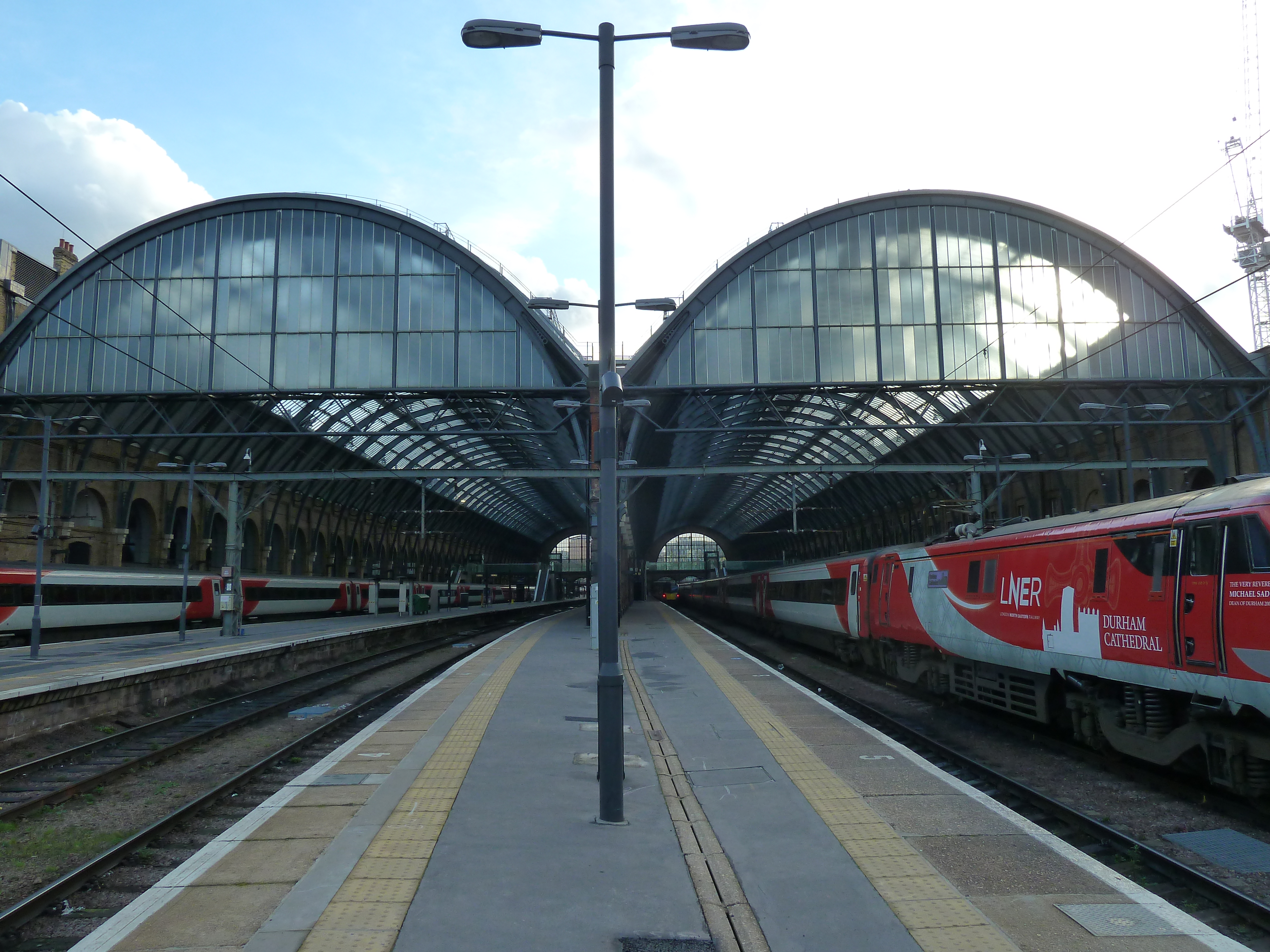
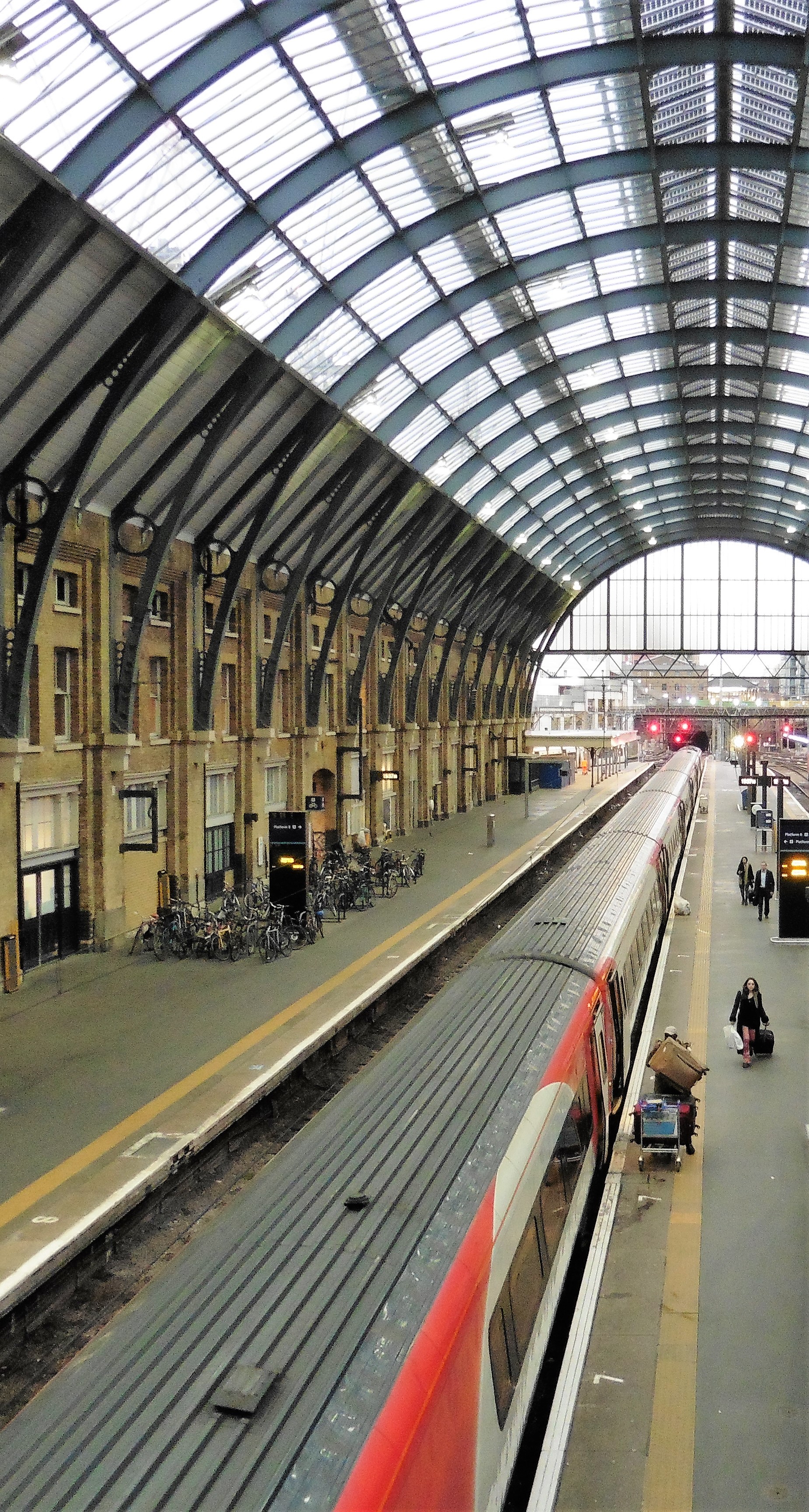
A practical station for a practical railway. That is how the Great Northern Railway saw it when they opened it in 1852. A station with a modest frontage, made from yellow London bricks and a wooden roof, complimented with two 100ft roof spans over the platforms. These roofs being supported by brick pillars, today in the centre of island platform 4 and 5.
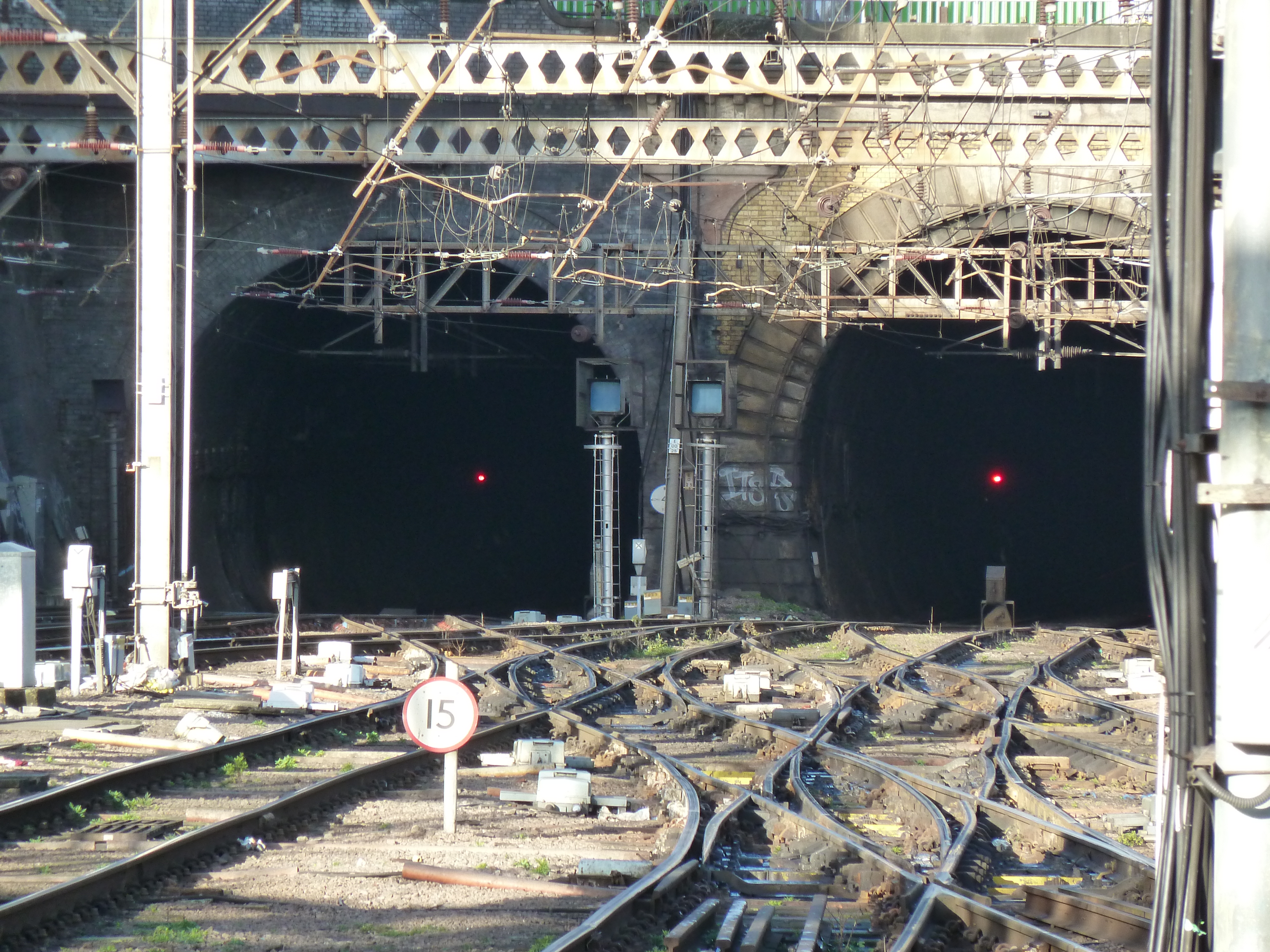
Trains enter and leave the station via the Gas Works tunnel, which passes under the Regent’s Canal. A major goods yard for coal was also contained within the station, although this does not remain.
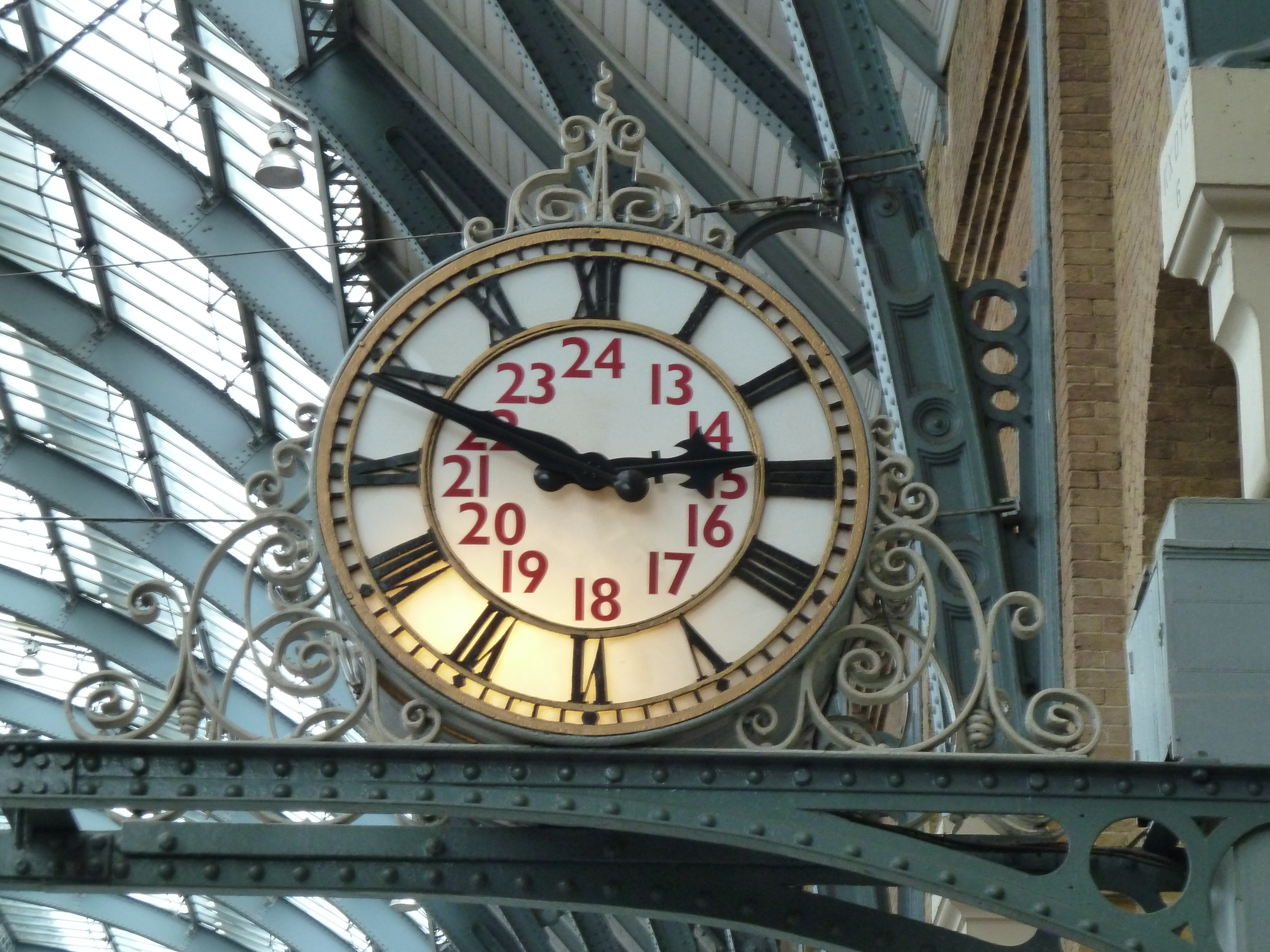
It looked totally at odds with St Pancras next door; that station when opened 16 years later was oozing with grandeur. A clock adorned the front of the building, and quirkily was rumoured to never have the same time showing as that of its neighbour at St Pancras. King’s Cross as a railway station, however, would for the majority of the next 150 years be the more successful of the two.
For all the footfall though, the station remained unloved for a long time. Indeed in the 1960’s, the square out front was partially covered with a new travel centre for British Rail. This however obscured the lower half of the original frontage, and looked at odds with it.
A quick view of the current station
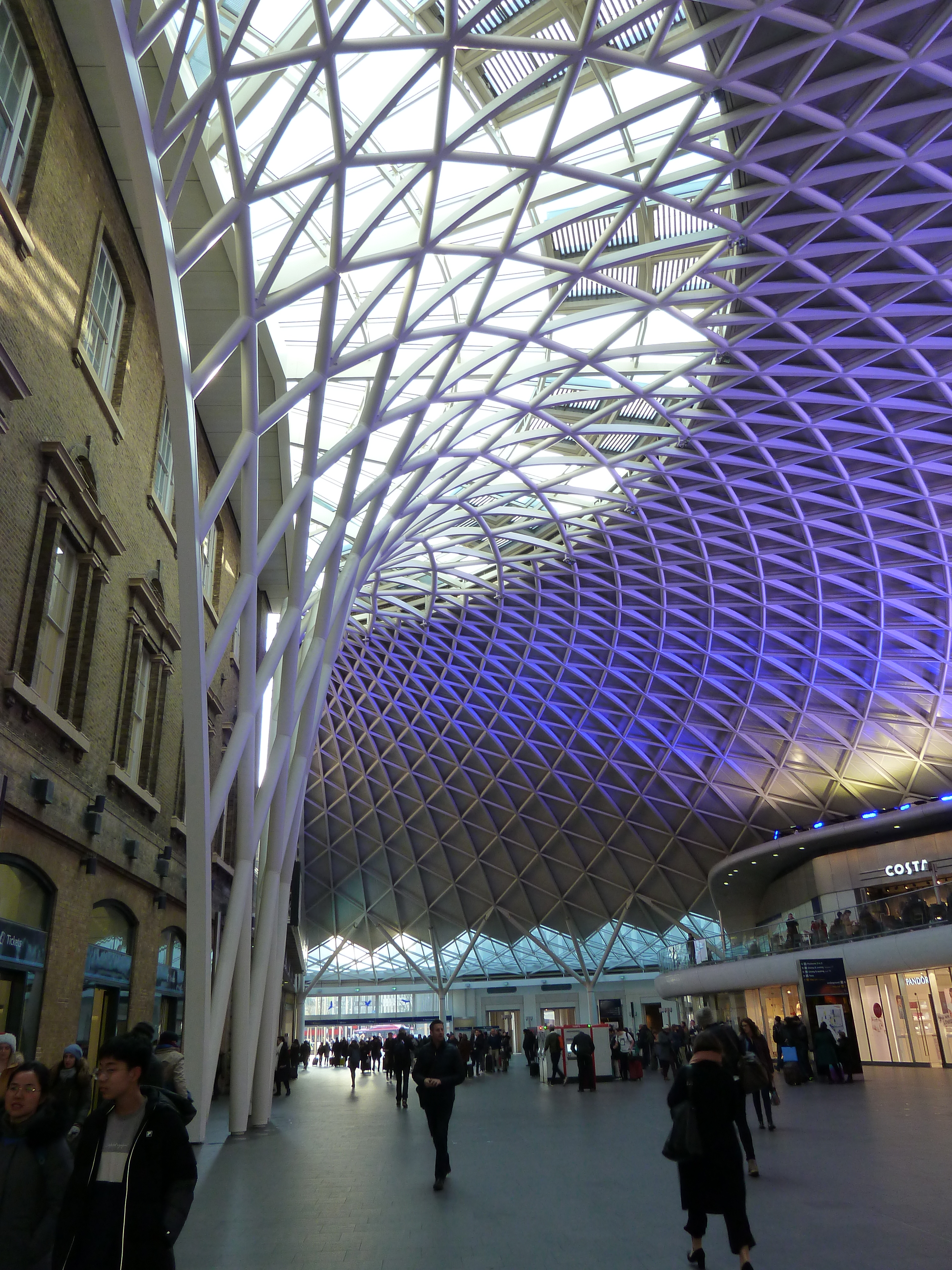
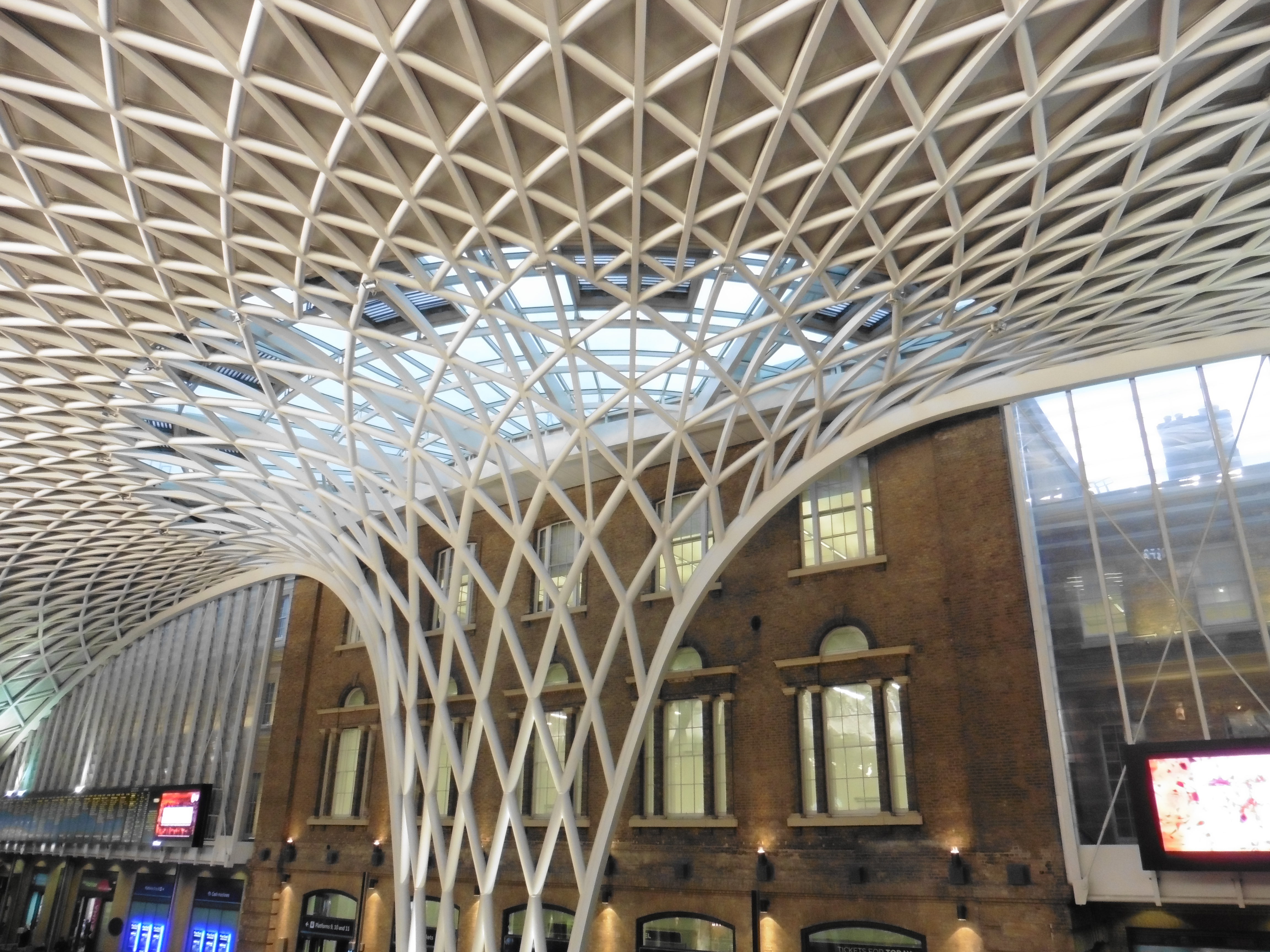
In 2007, work started on a new concourse, and what a unique structure it is. A single rising 150ft “Diagrid” roof, underpinned at its base down 50ft. It spreads out like a metal web, encapsulating the new concourse with its shops and bars. The feeling of space even during the busy periods is amazing, and differing colours are sometimes projected upon it.
The travel centre was removed, enabling the square to be reinstated and the full frontage to again be seen. To the left side of said frontage, an entrance to the new concourse can be seen. Going through this, the superb new roof opens up in all its splendour. Immediately to your right are entrance gates to the platforms, to your left are escalators up to a mezzanine level This contains a seating area and eating and drinking places.
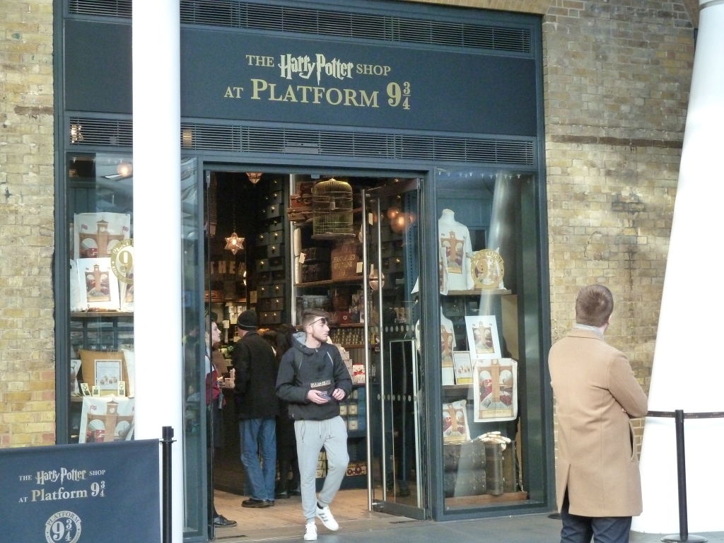
Going back down to floor level via the escalators on the other side of the mezzanine, if you turn right, you will see arrivals and departure boards, and underneath the new travel centre. To the left of the travel centre is the Harry Potter shop, with a photo opportunity platform 9 3/4 area.
Going under the mezzanine, more shops on both sides as you are then greeted with a glazed front, from which you can see St Pancras International. Stairs down to the Underground are also here, one of many access points to the labyrinth of tunnels which form King’s Cross St Pancras underground Station.
Pictures below were taken on 22nd January 2019, and thanks goes to the station manager and Network Rail for enabling me to photograph extensively on that date:
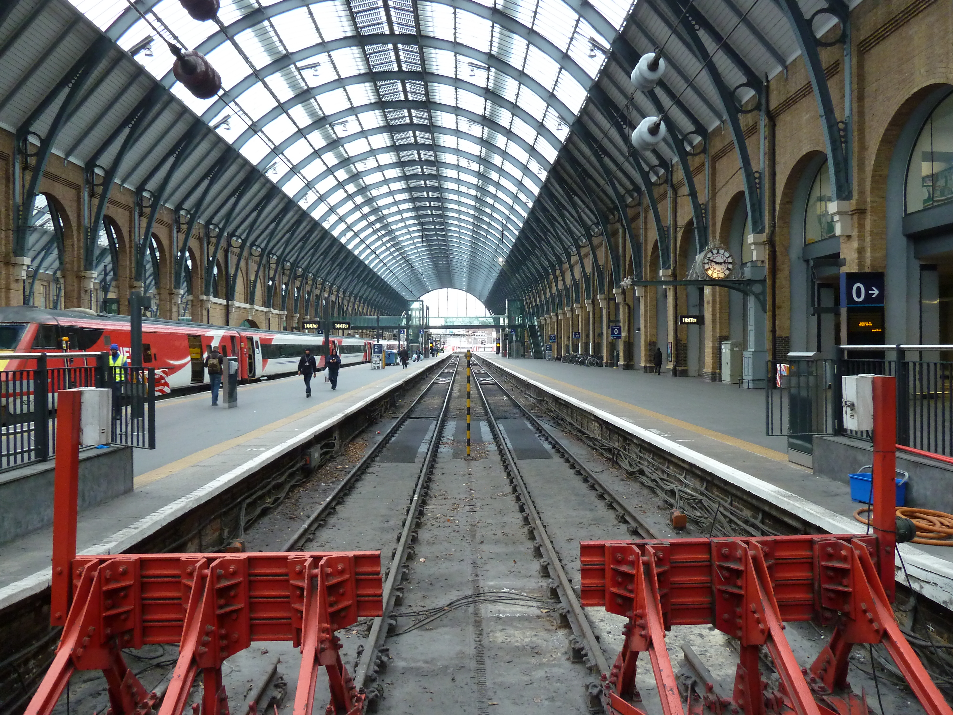
A view to the train sheds from the end of platform 10The view from island platform 4 and 5, showing the train shed, the centre brick column being obscured by the light fixture.The gasworks tunnels.A view down roads 1 and 2, notice platform 0 to the left.Clock situated on platform 1A view down to platform 6The fantastic canopy over the new concourseThe canopy. Note original station building behind.The Harry Potter shop – the photo opportunity “Platform 9 3/4” is immediately right of this, and is always busyThe fantastic exterior, with the square in the foreground
Here is a video, also taken on the day, from my YouTube site :
Please also visit Rainham Rail Enthusiast on my Facebook page.
Please also visit Rainham Rail Enthusiast on my Instagram Page.
In September 2018, I visited Didcot Parkway Railway Station, on the Great Western Main Line. A two fold visit actually, as I also visited Didcot Railway Centre on the same day. I had wanted to come to this Station for a while, as I had seen on videos that the views were fantastic, and I must say I was not disappointed.
Opened in 1844, just named Didcot, the station was a major hub for the Great Western, with connections available to Oxford (the main reason for the station at time of opening). There was also a line from here to Newbury and Southampton, however this was closed fully in 1967, passenger services being withdrawn some 5 years earlier. The oxford line (known as “The Cherwell Valley Line”) still operates, and is accessed by the station as well as the “East loop” for through trains.
The imposing Didcot Power Station is seen looking to the west. A loop for coal trains used to be in regular use, however after the closure of Didcot A, these ceased in 2013. Much of the track for this loop has now been lifted, to facilitate construction of new warehouses.
The station was given a new station building in 1985, as well as a 600 space car park. The station was renamed “Didcot Parkway” at this time.
A major redevelopment occurred in 2012, giving better access for disabled passengers, new CCTV and lighting plus better drainage on site.
Facilities here are the usual toilets, as well as lifts and a small “Pumpkin” Café which although well stocked, lacks a big seating area.
Services are plentiful. Trains “down” to the West country stop on Platform 1, whilst fast services “up” to Paddington leave from Platform 2. Platform 3 carries primarily trains to Oxford, and Platform 4 carries the trains from Oxford to London Paddington, on a stopping service. Platform 5 is used if Platform 4 is blocked for any reason, or for terminating trains from Paddington.
To the East of the station, extensive views can be had. The “East Junction” is also visible here.
A view to the west from platform 4 shows the covered area housing the café on platform 2-3. The construction work here is to lengthen the station platforms to accommodate the longer class 800 trains, which are replacing the HST’s on the routes to the west. Didcot Power Station is seen to the right in the distance.
Passenger traffic is served by the new Class 800 “IET”, HST, 387’s and 165’s. Vintage locos may also be seen leaving and entering Didcot Railway Centre , although these will most probably not be timetabled movements.
Freight is a regular sight at Didcot Parkway. Intermodal services run regularly through the station, as well as other freight heading to and from Oxford using the “east” Junction. These operations are mainly class 66, although the occasional class 70 or even 59 may be seen. Some freight may pass though or be temporarily stabled at Foxhall Junction.
All in all it was a great visit. Lots of different traction, the only downside was the weather, which was overcast, windy and eventually drizzly. However, the station is a fantastic place for photography and videography. I will return within the next couple of years, hopefully this time in the sunshine. Below is a video taken on the day.
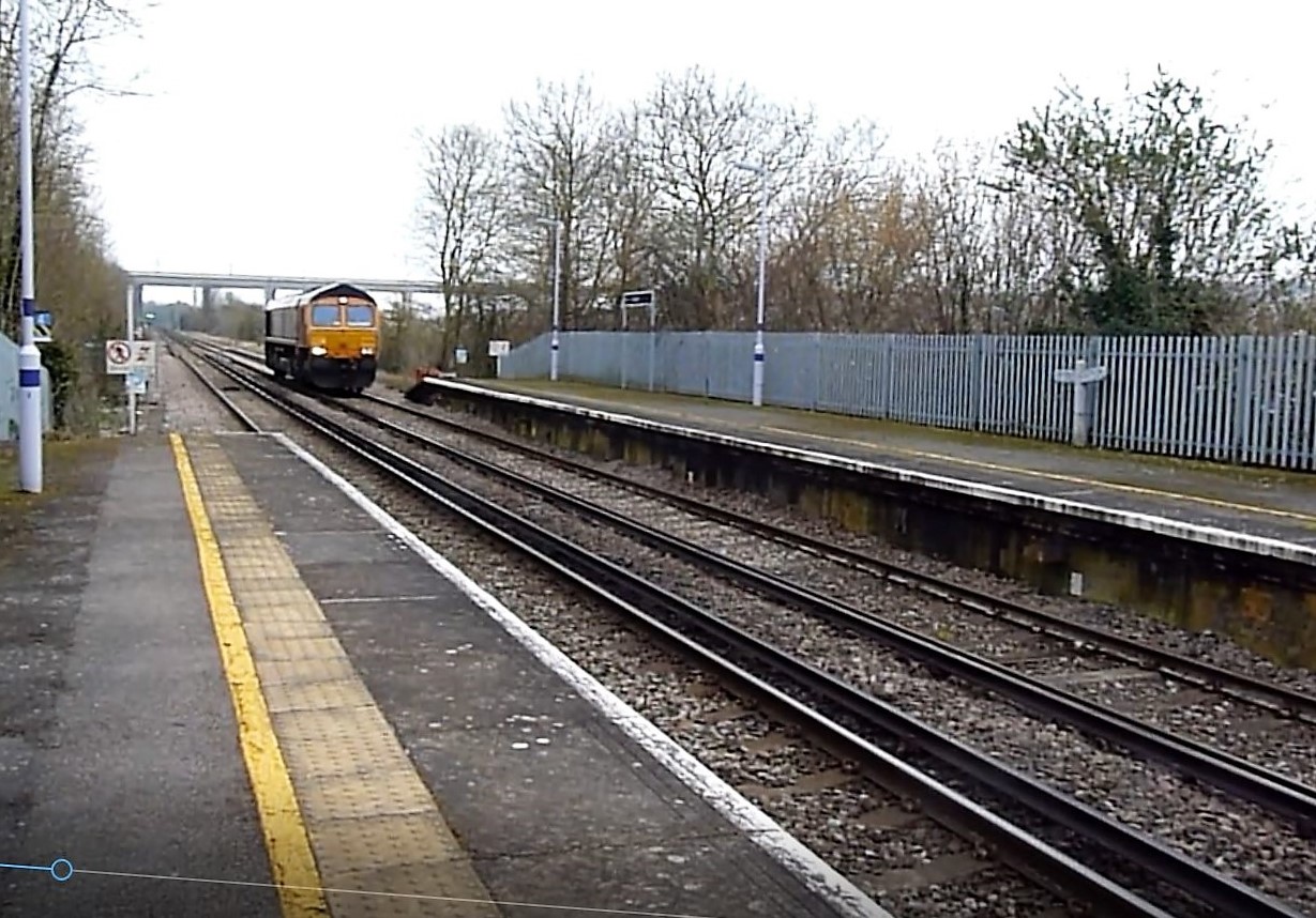
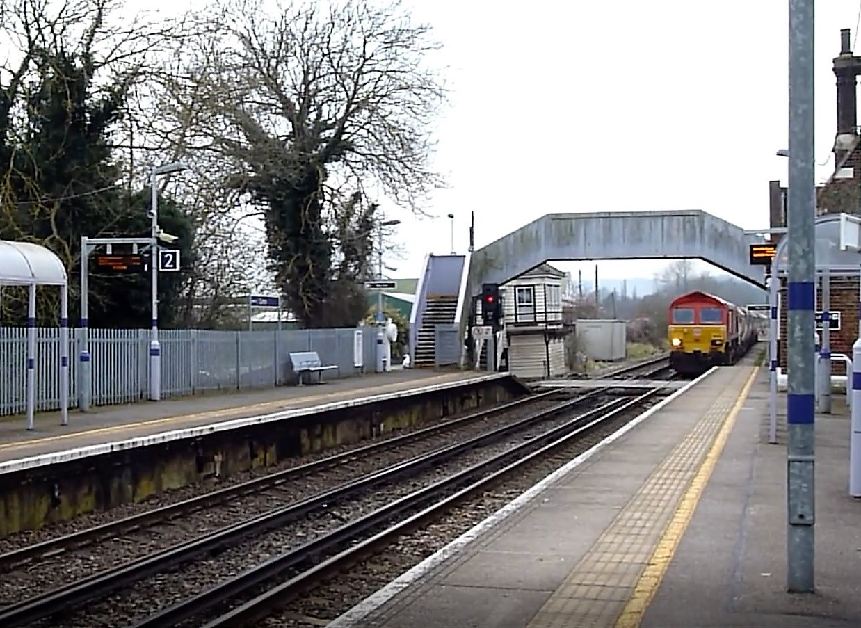
Continuing my look at stations in the Medway area, this time I shall look at a small station on the Medway Valley line – Cuxton.
Cuxton Station was opened in 1856, and from the outset had two lines. Two platforms served by an level crossing at the south end of the station allowed passengers to travel to Maidstone to the south, and Strood to the North. In 1862, a signal box was erected adjacent to this level crossing, and is still there today (2018)
In 1931 a small siding was opened to the south of the station, trailing off the “down” line, which served a national business (Besto Co.) making fruit baskets. This was followed in 1939 with a goods loop installed to the north of the station. Unfortunately, none of these sidings survive today, both having been removed by the end of 1990.
A footbridge was installed at the south end of the station in 1961, adjacent to the level crossing and the Signal box. A note about the level crossing, as it is still manually closed by the signalman at the time of this Blog (2018). A really rare sight, and (unfortunately) I will assume this will become automated at some time in the future.
Two views from Cuxton in 2016 follow. The first shows a light engine class 66, travelling on the “down” line towards Maidstone. This view is to the north, and the bridges across the M2 can be seen, the nearest one being the HS1 line.
The second view is to the south, showing the signal box, overbridge and level crossing, as well as a stone train travelling on the “up” towards Strood.
Currently at Cuxton, there is only a PERTIS (permit to travel) machine installed here, the majority of the station buildings being disused for many years. The station is served at this time by Southeastern, with 2 trains per hour (northbound “up” to Strood, southbound “down” to Maidstone (1 Tph continues to Paddock Wood, the other to Tonbridge). (correct as of June 2018)
A few freight trains run though the day, to or via Hoo Junction (to the north) or to the south, some of which come from or go to ARC sidings just outside Allington in Maidstone. Freight is mainly hauled by class 66 locomotives, although some class 70’s have also been seen on the line.
In the June of 2017, I visited Banbury Railway station, with a short trip to Heyford. I had seen many videos from the station with its varied traction, but mainly wanted to see the Chiltern Railway services from London Marylebone to Birmingham, some of which are class 68 / 67 hauled. The day certainly didn’t disappoint.
Firstly a little history. Banbury Railway Station opened in 1850 as Banbury Bridge Street Station, for the GWR. At first it was just a single line station, but due to popularity was increased to double track a few years after opening. Goods loops were also installed around the station, notably adjacent to the “up” line. This also provided access to the LNWR route via another Station, Banbury Merton Street. Further terminating bays and goods loops followed, cementing Banbury’s importance in the rail network. In 1948 during nationalisation, the station was renamed Banbury General.
Banbury Merton Street closed in 1960, and with that Banbury General was renamed Banbury. Some, but not all, of the goods loops around the station have subsequently been removed, and the station now has 4 lines, served by three platforms.
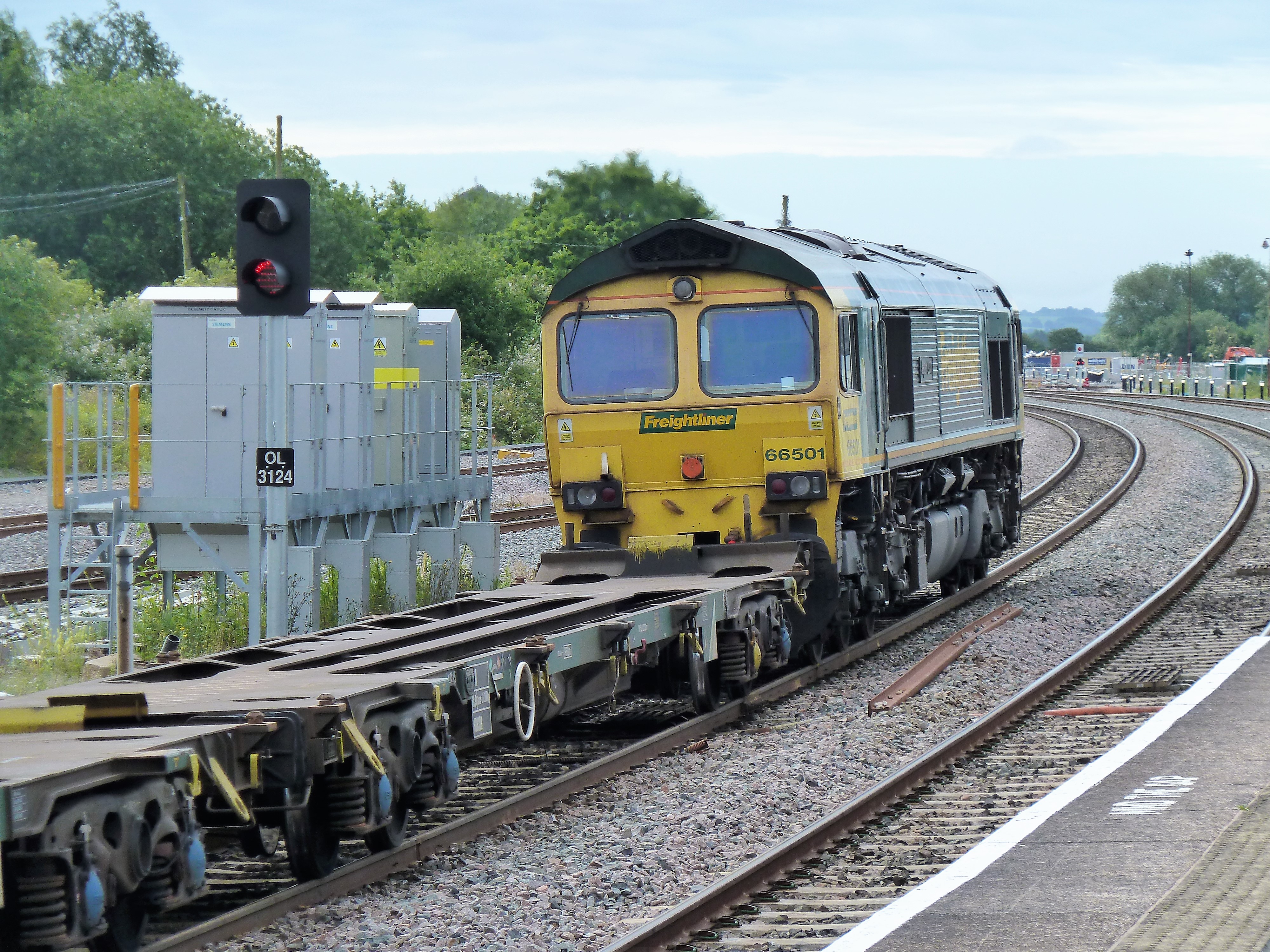
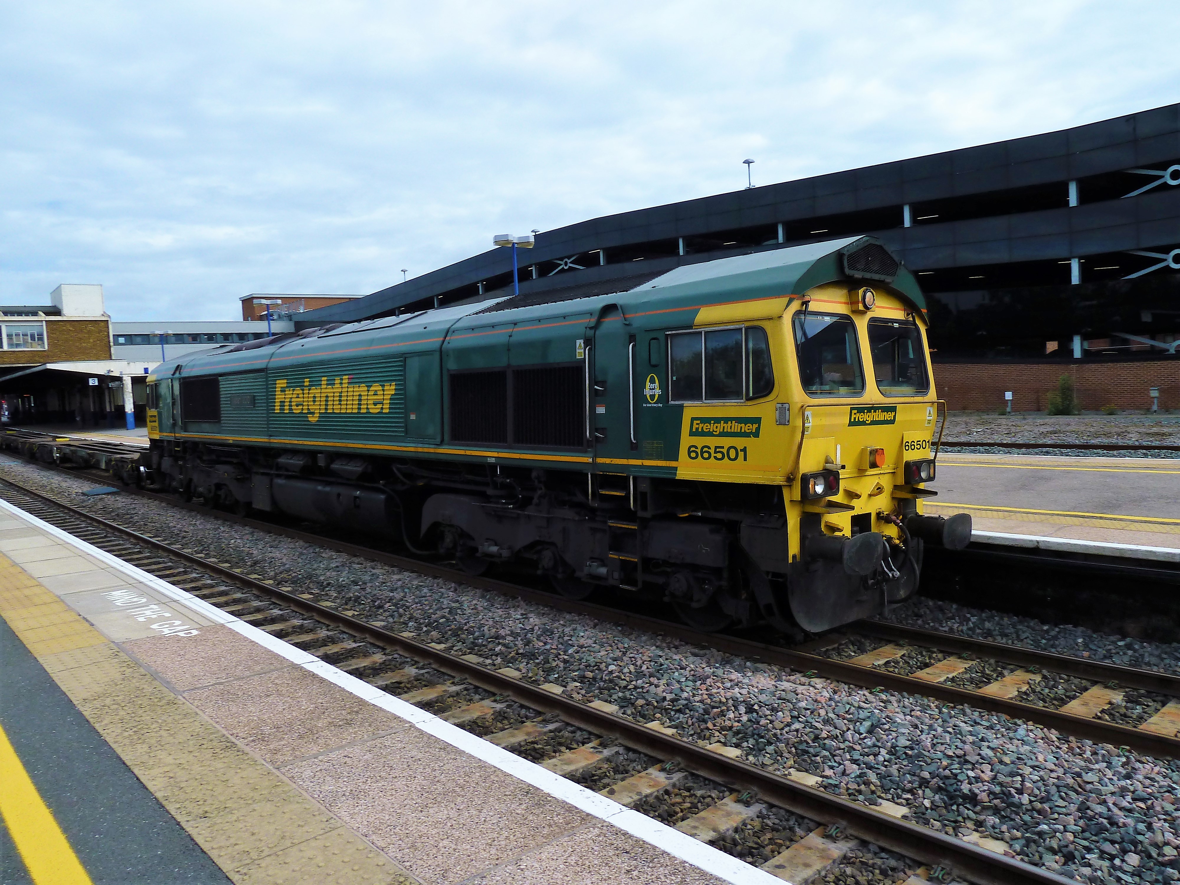
Many freight services pass through Banbury, mainly intermodal workings from/to Southampton. Below are two images of Freightliner 66 501s working on the “Up” line from Southampton docks towards London.
The main current (2018) passenger services are as follows :
Chiltern Railways:
3 tph to London Marylebone 2 tph to Birmingham Moor Street, 1 of which carries on to Birmingham Snow Hill
Cross Country:
Services to Bournemouth, Manchester, Reading and Newcastle
GWR
Cherwell Valley line services to Reading and Didcot Parkway
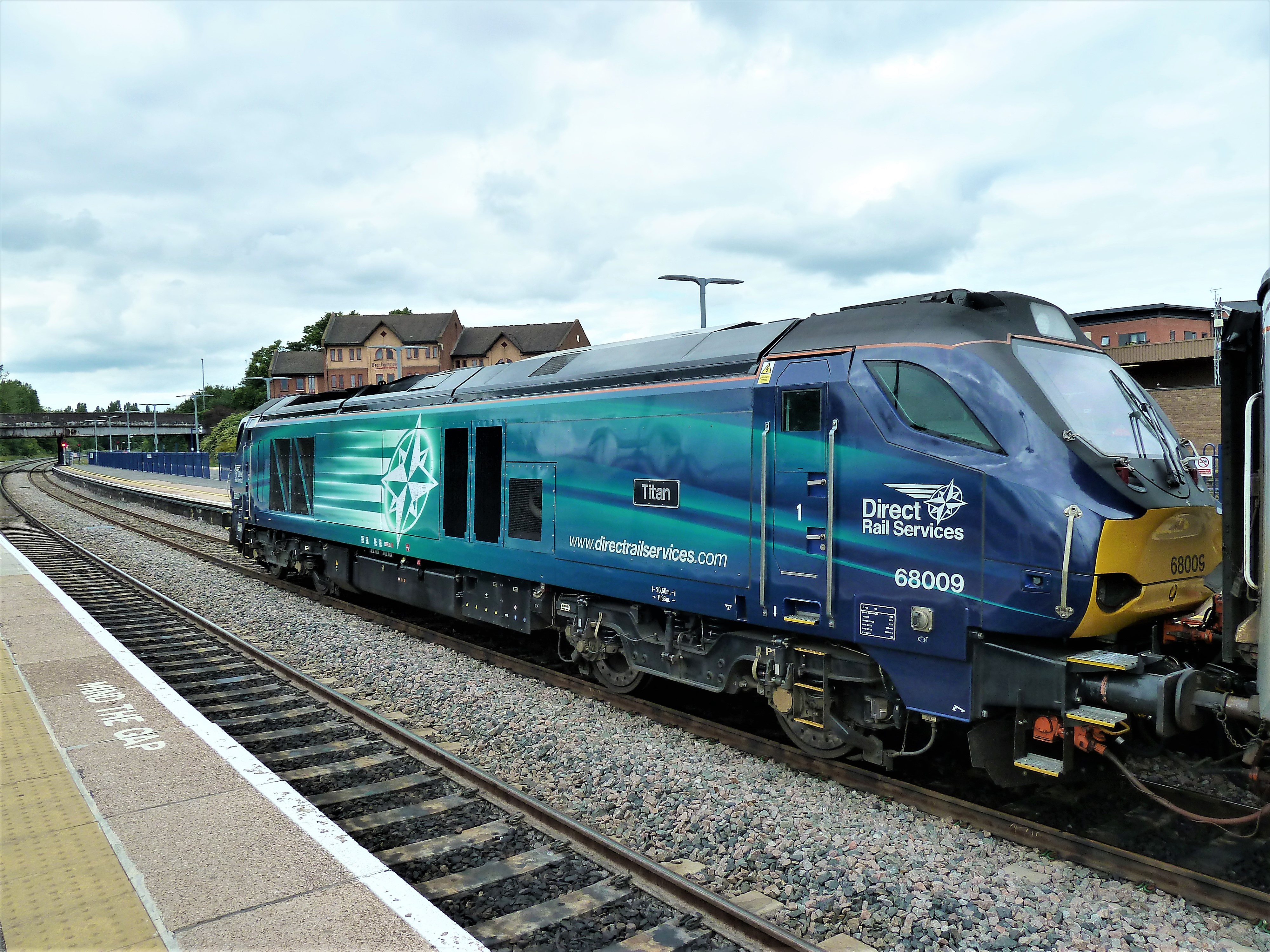
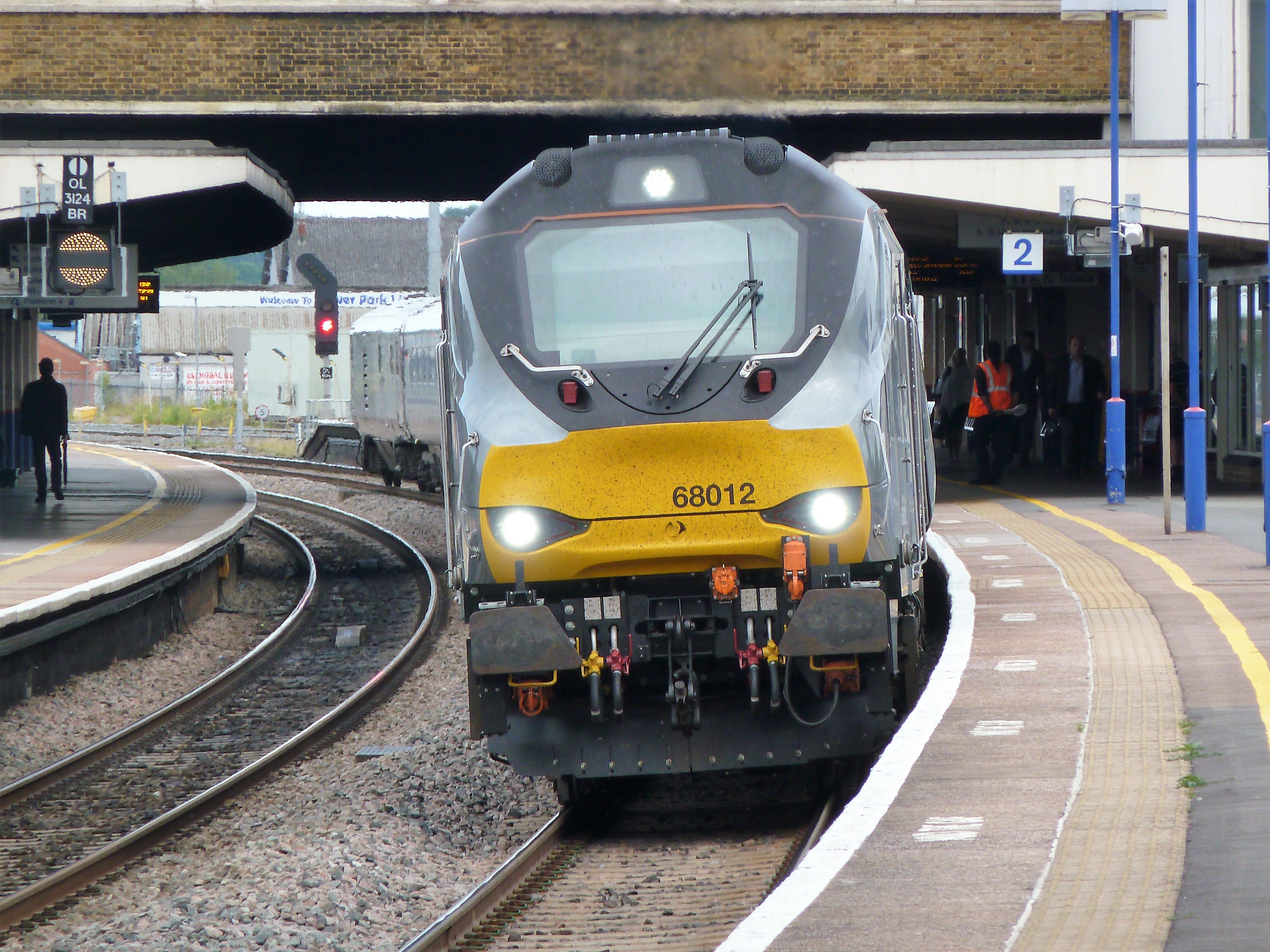
As you can see, it really is a gateway across a good part of the country! The two pictures below are of Class 68 locomotives, on loan from DRS, on services to London Marylebone (top) and Birmingham New Street (bottom) for Chiltern Railways.
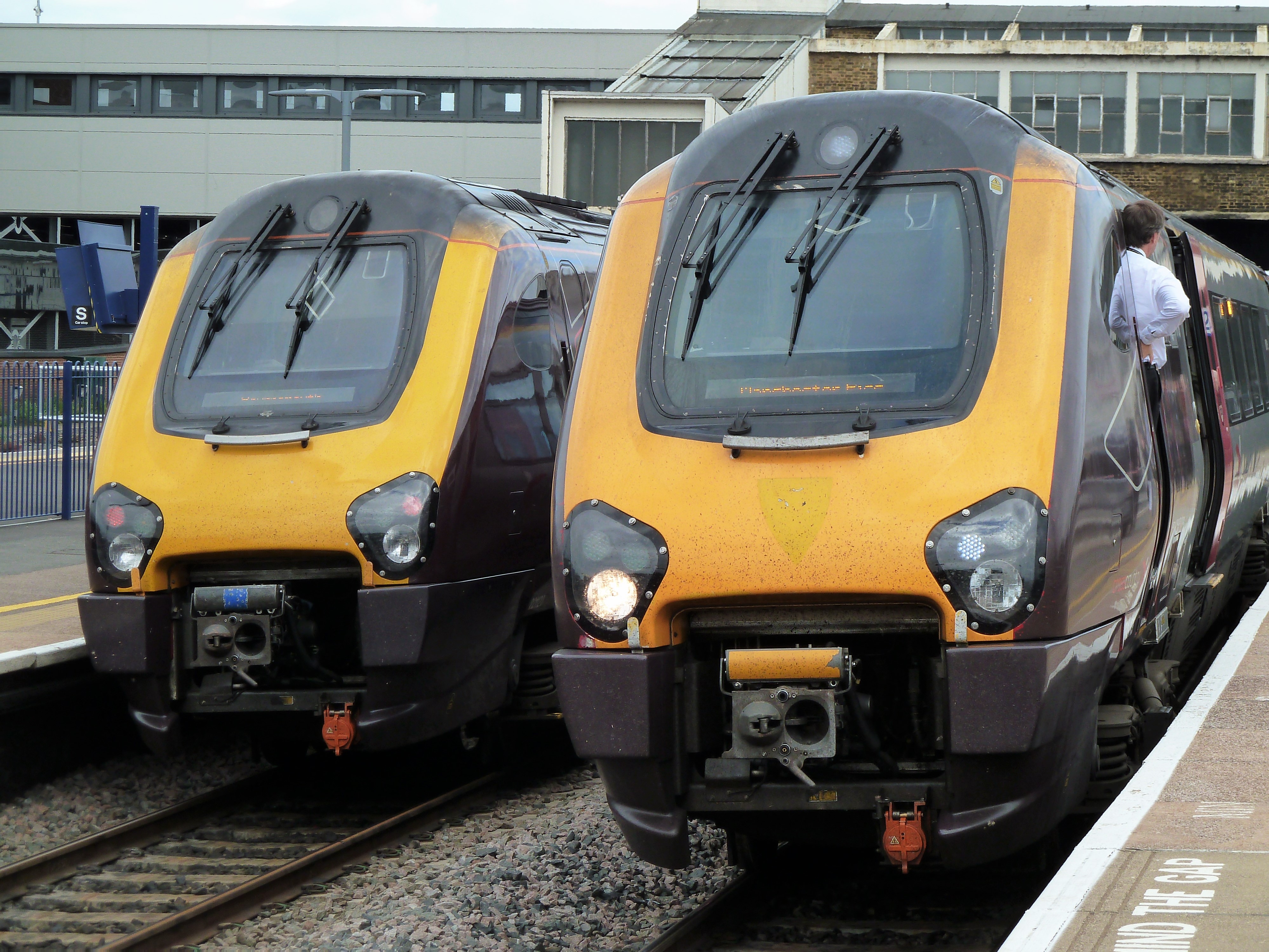
And here are a couple of Cross Country Voyagers, en route to Manchester and London respectively.
I have also posted a video to my YouTube channel, and this can be seen below:
The station staff are friendly and are ok with photography / video work, obviously with the rules of the railway always being adhered to. I really enjoyed my visit here, so much going on with all different types of traction, and hope to visit again in the future.